

Oh lead me into temptation
… despite the price of fuel, despite the bad roads
With the abundance of water in the region the Eastern Free State provides the visitor with spectacular scenery and nature can be a stimulating retreat.
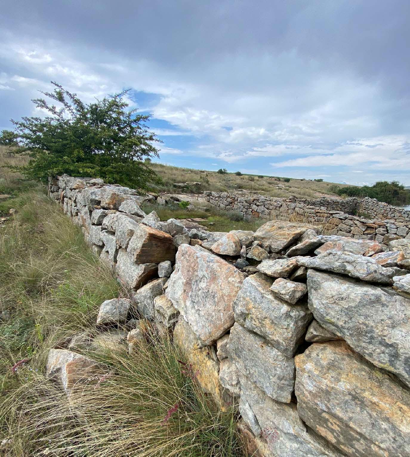
I shall travel the gravel roads of the Eastern Free State. I do not need a 4×4, although a bigger vehicle might add comfort. But then again, a smaller vehicle might improve my driving skills. I might learn how to negotiate the potholes, or to drive two wheels in the track and two off. I do realise this requires slow driving, but that is exactly what it is all about – slow travelling. And why? Because we are scouting.
We make many stops, take many photographs, and even walk short distances. The thing about the outdoors … it never ceases to amaze, to heal, to delight, to inspire. Affording the opportunity to easily retreat into nature, leaving behind concerns, worries or whatever troubles you may be facing, and stimulated by the surroundings, experiencing the joy shared with your dogs – mine, who despite their age enthusiastically scout the area – is sheer delight. One needs a standstill to look around, and often. Only then do you once again become aware of the greatness of creation.
There are three classes of people, said Leonardo da Vinci, those who see, those who see when they are shown, and those who do not see.
Visitors to the Eastern Free State often remark how wonderfully green it is, whilst back home everything seems to turn brown.
Well friends, it is because we have the water, which we generously share with other parts of the country. The Jordaan River flows through Bethlehem; it originates in the Rooiberge (red mountains) near Clarens and flows north towards the southern part of Bethlehem, channels through Pretorius Kloof Nature Reserve and eventually converges with Loch Lamont. From there it joins the Liebenbergsvlei River.


Our neighbouring country, the Kingdom of Lesotho, is approximately 1 800 m above sea level. Thaba Ntlenyana reaches an elevation of 3 482 m. The annual rainfall of 761,2 mm usually occurs from October to April. Based on these facts, it was decided to build the Katse Dam to supply South Africa with water and provide the ability to generate hydroelectric power.
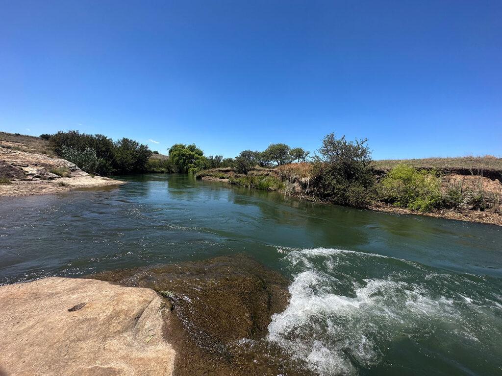
The Axle River, in Afrikaans the Asrivier, originates in the Rooiberge. Originally it was a small stream. The river is rather known as the Ash River, but it was mistranslated from the Afrikaans, Asrivier, meaning the axle of a wagon. “As” in Afrikaans could also mean the remains of burnt wood, hence the confusion.
With the development of the Highlands Water Scheme (Katse), the Axle River was elevated to higher status, and became a strong flowing enduring river, a conduit for water.
The Liebenbergsvlei River, a tributary of the Wilge River, originates southeast of Bethlehem. It empties into the Saulspoort Dam where the water is compounded and supplies the town of Bethlehem with water. The Saulspoort Dam was renamed Sol Plaatje Dam after a bus with churchgoers, from the Sol Plaatje municipality, drove into the dam on 1 May 2003. 51 people drowned and it is still regarded as one of the worst bus accidents in the world.
These rivers flow north, the Axle spills into the Saulspoort Dam, as does the Liebenbergsvlei River, which originates southeast from Bethlehem. From here the Liebenbergsvlei River continues its journey to the Wilge River, which flows into the Vaal Dam.
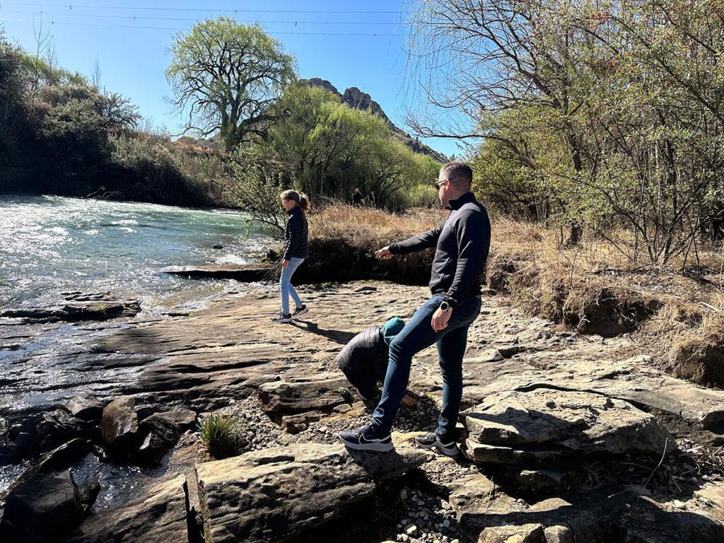
There is a saying, where there is water, there is life. Indeed. The Axle River offers exhilarating white-water rafting, and the river guides are extremely well trained. The journey takes 60 minutes through four rapids, the last one being Grade 4. Never underestimate the power of water; one’s ego can get seriously bruised. I got shot out of the raft on the fourth rapid after meticulously following each instruction. I went under; the current was rough and strong, and I remembered the guide cautioning, if we fall out the raft (wearing life jackets, of course), we should not panic – we just needed to count to 10. If, he said, we got to 10 and we had not surfaced yet, it meant we counted too fast! So, I started counting for the second time and am here to tell the tale.
There are two hydro plants in the Axle River. Another attribute is the splendid photo opportunities. Some of the gravel roads run along the river; one can either drive or hike the water’s edge.
There are apart from hiking and running, opportunities for mountain biking. Consider the fact that the Eastern Free State is approximately 1 700 m above sea-level with an annual rainfall of 1 020 mm. In the rainy season the rivers rise and overflow their banks but subside quite rapidly. So, good rainfall leaves splendid scenery which adds to the pleasure of the hikes. South of Bethlehem runs the S1141 gravel road, one of my favourite routes to walk. The farmers keep the road in a good condition and it eventually crosses the Jordaan River, which is quite a sight when it is in flood.
On both the Loch Athlone and Saulspoort dams various kinds of water sports are popular. Like I said, we always have water.
Another great outdoors pastime in the area is birdwatching. Although I am not an expert, I have started noticing bird species on my regular hikes that I have not seen before. Imagine the sightings for the serious birdwatchers!
Sure, we do not have an ocean, or nightlife, theatres, and shopping malls (although there is a nice one in Bethlehem if that’s your thing), but we have all the rest! Can the Eastern Free State be regarded as a holiday/weekend destination? Of course! We have far more to offer, this is only an introduction.